Boundary Disputes Protocol | RICS Disputes Mediation
What are the Boundary Disputes Protocols?
Boundary disputes in England and Wales often emerge when neighbours disagree over the precise delineation of the boundary line that separates their properties. These disputes can rapidly escalate, becoming both complex and acrimonious, thus necessitating a structured approach to resolution. The
This protocol underscores the importance of engaging in alternative dispute resolution (ADR) methods, such as mediation, expert determination, and negotiation, to resolve disputes amicably and efficiently. ADR reduces the emotional and financial strain on the parties involved, preserving neighbourly relations and avoiding the need for litigation, which can often be disproportionately expensive relative to the value of the land in question.
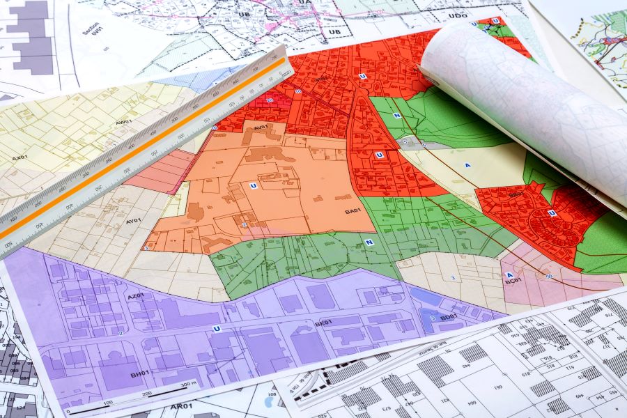
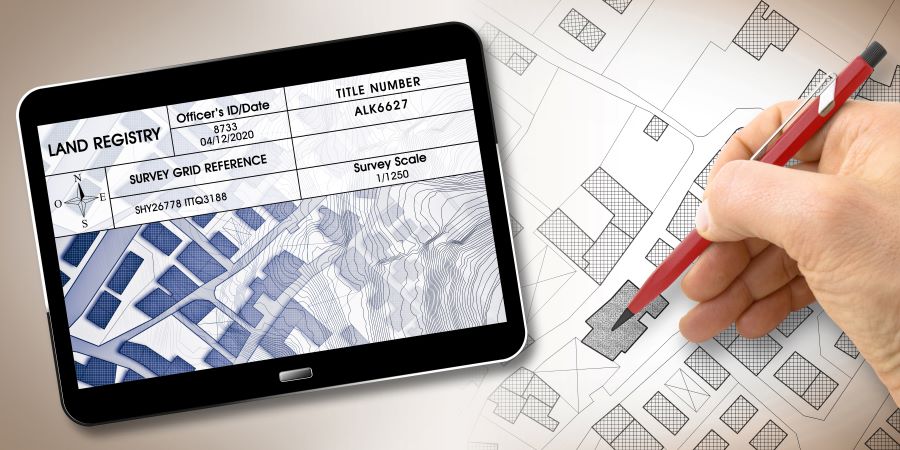
Chartered Surveyors play an indispensable role in the resolution of boundary disputes. They are uniquely positioned to offer professional advice on the location of the boundary, drawing upon physical inspections, historical analysis, and interpretation of legal documents. Surveyors can also contribute to drafting a boundary agreement, a document that, once finalised and executed by the parties, can be submitted to the Land Registry to record the agreed-upon boundary line officially. Their expertise ensures that any agreement is based on accurate and professional assessments, providing a solid foundation for any negotiated resolution.

The
The Boundary Disputes Mediation Service (BDMS), a joint initiative by RICS and the Property Litigation Association and supported by the Civil Justice Council, presents an alternative dispute resolution method for boundary issues between neighbours. This service offers a quicker, more cost-effective, and less formal approach than traditional litigation, focusing on constructively resolving the fundamental aspects of disputes.
However, should these efforts fail to yield a resolution, litigation under the guidance of the Civil Procedure Rules may become inevitable. The protocol, therefore, emphasises that litigation should be considered a last resort, pursued only after all other avenues have been exhausted. It warns that the courts may view parties who bypass the protocol's steps unfavourably, potentially impacting legal costs and outcomes decisions.
The Property Litigation Association endorses the
Boundary Dispute Quotation
When to decide on Property Litigation?
Deciding to pursue property litigation, particularly in boundary disputes, is a significant step that should be considered carefully and typically as a last resort. Given the complexities and potential for escalated costs and strained neighbourly relations, litigation should be pursued only after all other avenues for resolution have been exhausted. Here's an overview on when to decide on property litigation:
Exhaustion of Alternative Dispute Resolution (ADR): If attempts to resolve the dispute through mediation, negotiation, or expert determination—guided by professional advisers like Harding Chartered Surveyors—have not resulted in an agreement, litigation may be the next step.
Clear Legal Grounds: Litigation should be considered when there is strong evidence to support your position regarding the boundary dispute, especially after a thorough analysis and professional advice from chartered surveyors and solicitors.
Failure of Informal Resolution Attempts: When informal discussions and negotiations, even with the assistance of professional advisers, fail to bring about a resolution, and when there is a significant impact on the value or use of your property, litigation may be necessary.
Adverse Possession Claims: In cases where there is a claim for adverse possession and no agreement can be reached through other means, litigation may be the appropriate course of action to resolve the ownership and boundary issues.
Compliance with Protocols: Ensure that all steps recommended by the Boundary Disputes Protocol have been followed, including exchanging sufficient information and attempts at resolution through ADR methods. Litigation is more justifiable when these protocols have been followed without resolving the dispute.
Consideration of Costs vs. Benefits: It's crucial to assess whether the potential benefits of litigation (such as securing your property rights or resolving a long-standing boundary issue) outweigh the financial and emotional costs involved.
Legal Advice: Finally, the decision to proceed with litigation should be made based on comprehensive legal advice. A solicitor specialising in property disputes can offer insights into the likelihood of success, the potential costs involved, and the overall impact on your property and personal well-being.

Boundary Disputes Protocol
Determining the Boundary Line
Determining the boundary line between properties can be complex, requiring a combination of historical research, legal analysis, and professional expertise. Here's a concise guide on how to determine the boundary line:
Review Legal Documents: The first step is to review any legal documents related to the property, including the title deeds and Land Registry records. These documents may contain descriptions, plans, or references to the boundary lines during the original conveyance or subsequent transactions.
- Importance of the First Conveyance: In most cases, to resolve a boundary dispute, it's necessary to refer back to the first conveyance document that separated the ownership between your and your neighbour's land. This document, rather than the Land Registry or the oldest conveyance in your title's unregistered root, is crucial for determining the boundary's location. The interpretation of this first conveyance, considering the wording and the physical features at the time, is often the key to resolving the dispute. Subsequent actions or conveyances might also play a role in some situations.
Historical Analysis: Examining historical documents, maps, and aerial photographs can provide insights into the original boundaries and any changes over time. This historical analysis can help identify established boundary features or alignments.
Physical Inspection: Conduct a physical inspection of the property to identify existing boundary features such as fences, walls, hedges, or markers. The physical features often give a practical indication of the boundary line, although they may not always align with legal documentation.
Professional Survey: Engaging a professional chartered surveyor, like those from Harding Chartered Surveyors, is crucial for accurately determining the boundary line. Surveyors can interpret legal documents, conduct detailed measurements, and produce precise plans establishing the boundary's location. They can also consider any physical and historical evidence to support their findings.

The RICS Boundary Disputes Mediation Service
The Boundary Disputes Mediation Service (BDMS) is a collaborative effort by the Royal Institution of Chartered Surveyors (RICS) and the Property Litigation Association, with backing from the Civil Justice Council. It offers neighbours an alternative way to resolve disputes concerning boundary lines and related matters. Compared to the traditional litigation route, BDMS provides a faster, less expensive, and more informal solution, aiming to address the core issues of the dispute in a constructive manner. Through mediation, parties are empowered to take control of their dispute resolution process, facilitating an environment where an agreeable outcome for all involved can be more easily achieved. This approach underscores the many benefits mediation offers in resolving boundary disputes.

Harding Chartered Surveyors - Professional Advisers for Property Protocols
Harding Chartered Surveyors, as professional advisers, play a pivotal role in navigating the complexities of boundary disputes in the UK. With their expert knowledge and experience, they offer invaluable assistance to property owners who disagree on the precise location of boundary lines between their properties. Here’s how Harding Chartered Surveyors can help in resolving such disputes effectively:
Expert Analysis
Harding Chartered Surveyors can thoroughly analyse the disputed boundary, employing their technical expertise to interpret historical documents, Ordnance Survey maps, and existing Land Registry plans. This expert analysis is crucial for establishing the boundary's factual position, which forms the basis for any resolution process.
Professional Advice
Upon assessing the specifics of a boundary dispute, Harding Chartered Surveyors provide professional advice on the best course of action. This includes interpreting the implications of the boundary's location, advising on the potential for an adverse possession claim, and suggesting the most suitable form of alternative dispute resolution (ADR) to pursue, whether that be mediation, negotiation, or, if necessary, litigation.
Mediation and Negotiation
Harding Chartered Surveyors can mediate or negotiate disputes, facilitating discussions between neighbours to reach a mutually acceptable agreement on the boundary's location. Their impartiality and focus on factual evidence can help de-escalate tensions and guide parties towards a practical resolution without court intervention.
Representation
In cases where disputes cannot be resolved through negotiation or mediation and proceed to a tribunal or court, Harding Chartered Surveyors can provide expert representation. This includes preparing detailed reports, giving evidence, and supporting the case with professional insights into the boundary's history and the technical aspects of its location.
Ensuring Compliance
Throughout the dispute resolution process, Harding Chartered Surveyors ensure that all actions comply with the relevant legal frameworks and guidelines, including the Boundary Disputes Protocol. This ensures that any resolution is agreeable to both parties and legally sound and sustainable.
Minimising Disputes
By involving Harding Chartered Surveyors early in the dispute process, property owners can minimise the scope for disputes by providing clear, accurate, and impartial advice. Their involvement helps to clarify misunderstandings, provides a clear basis for any claims, and, ultimately, leads to a more timely and cost-effective resolution of boundary disputes.
Recent Reviews from Harding Chartered Surveyors
Conclusion
The Boundary Disputes Protocol serves as an essential non-binding pre-action protocol developed to guide the resolution of disputes between neighbours over the location of their boundary. This protocol applies where neighbours dispute the boundary feature that delineates their properties, offering a structured dispute resolution process to clarify the position of the boundary without litigation. Central to the protocol is the principle that neighbours exchange sufficient information within four weeks of a dispute arising, a step designed to ensure that both parties clearly understand each other's position regarding the historical boundary and the land adjoining a general boundary.
The protocol aims to mitigate the complexities surrounding ownership of a boundary, land registry title, and any claim for adverse possession that may emerge. It encourages neighbours to consider whether some form of alternative dispute resolution could settle the dispute amicably, thereby avoiding the emotional and financial costs associated with protracted legal battles.
The protocol stipulates that, within six weeks, parties should summarise their discussion and agree whether any determined boundary exists based on past conveyances, the Land Registration Act 2002, and any relevant historic boundary agreement. This step is crucial for establishing whether the land at the time of the conveyance, which has now passed into separate ownership, has a clearly defined boundary agreement in the official records or if a new boundary agreement needs to be formalised.
Furthermore, the protocol encourages parties to consider the position of the general boundary and the squatter “reasonably" claiming ownership of a boundary feature or land for at least ten years. This is particularly relevant in resolving boundary disputes involving claims for adverse possession, where a party claims to have occupied land for 12 years or more without the owner's consent.
The ultimate goal of the Boundary Disputes Protocol is to resolve boundary disputes quickly and efficiently, ensuring that neither party incurs disproportionate costs or experiences undue stress. By requiring that neighbours are in dispute to exchange sufficient information and to seek legal advice, the protocol aims to minimise misunderstandings and facilitate a resolution of the dispute that respects the legal issues and historical nuances relating to their property boundaries.
Many boundary disputes can be resolved through this protocol, which advocates for attempts to resolve the dispute through negotiation or other alternative dispute resolution before any litigation is pursued. Property litigation solicitors play a vital role in this process, offering expert guidance on the intricacies of property law, the interpretation of land registration documents, and the best course of action for parties looking to agree on the boundary between their properties.
In summary, the Boundary Disputes Protocol is a testament to the value of structured dispute resolution processes in mitigating the often complex and fraught disputes between neighbours about the location of property boundaries. By fostering an environment where neighbours exchange sufficient information promptly and seek to understand the historical context of their boundary, the protocol offers a pathway to resolving disputes that balance the legal, emotional, and financial realities the parties face.


